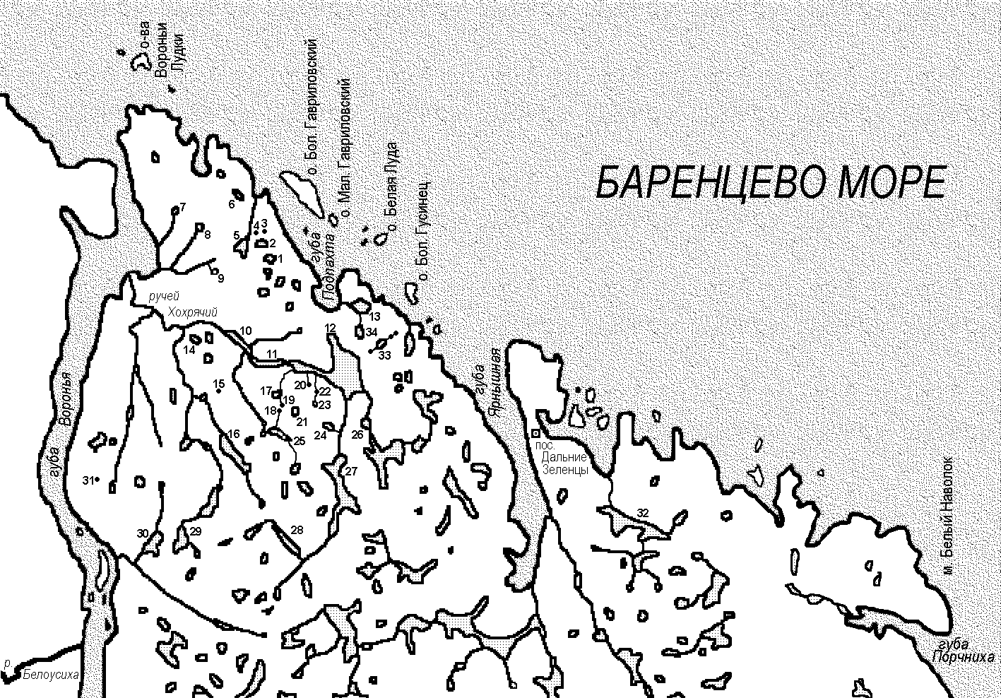
The scheme was prepaired on the base on topographic Joint Staff map 1:200000. Lakes, that were investigated by expedition, are numbered. Lakes, that were laking on the map, were marked on the scheme with dots, basing on GPS data. Conventional names of nameless lakes, that were given by expedition staff, are put in inverted commas.
1 -- Pomorskoje-1
2 -- Pomorskoje-2
3 -- Pomorskoje-3
4 -- Pomorskoje-4
5 -- Pomorskoje-5
6 -- Pomorskoje-6
7 -- Kupal'noe ("Luchsheje")
8 -- "Voronje-2"
9 -- "Invaginatsiya" ("Apchkhi")
10 -- Pjeschanoje
11 -- Chasovoje
12 -- Podpakhtinskoje
13 -- Krutik
14 -- "Lakhtachje"
15 -- "Jarus"
16 -- "Zatsepjavr"
17 -- "Podjonochnoje"
18 -- "Nadpakhtinskoje"
19 -- "Dorozhka"
20 -- "Plavuntsovoje"
21 -- "Utitsa"
22 -- "Imago"
23 -- "Dostaljnoe" ("Djevjatka")
24 -- "Edinitsa" (wasn't investigated)
25 -- "Chervjak" (wasn't investigated)
26 -- "Djuzhina"
27 -- Pozdnjakovskoje (Shvedskoje)
28 -- "Svjaznoje"
29 -- "Lipkoje"
30 -- Grigor'evo ("Kashpo")
31 -- "Zapjatoe"
32 -- Zjeljenetskoje
33 -- Bol'shoje Kaskadnoje
34 -- "Pennoje"